These are some photos taken on a round-trip from our home in Logan Lake, southern interior BC, to the Cariboo-Chilcotin region in west-central BC, then by ferry from Bella Coola to Port Hardy on Vancouver Island, south to Victoria, ferry to Vancouver and then home. My brother Damien and his wife Marianne were visiting from South Africa and that prompted us to do this trip – visiting several places we ourselves had not seen in our home province.
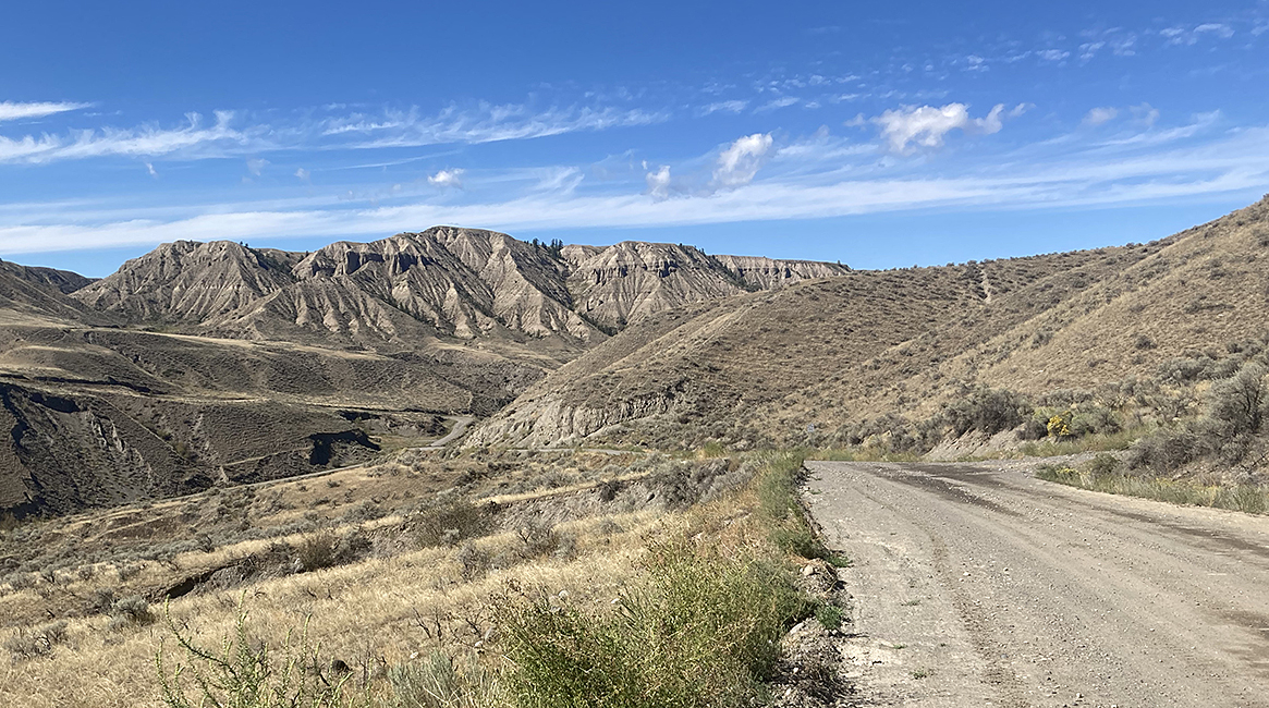
From Logan Lake we went on highways to Clinton and then on back roads into the Cariboo-Chilcotin region.
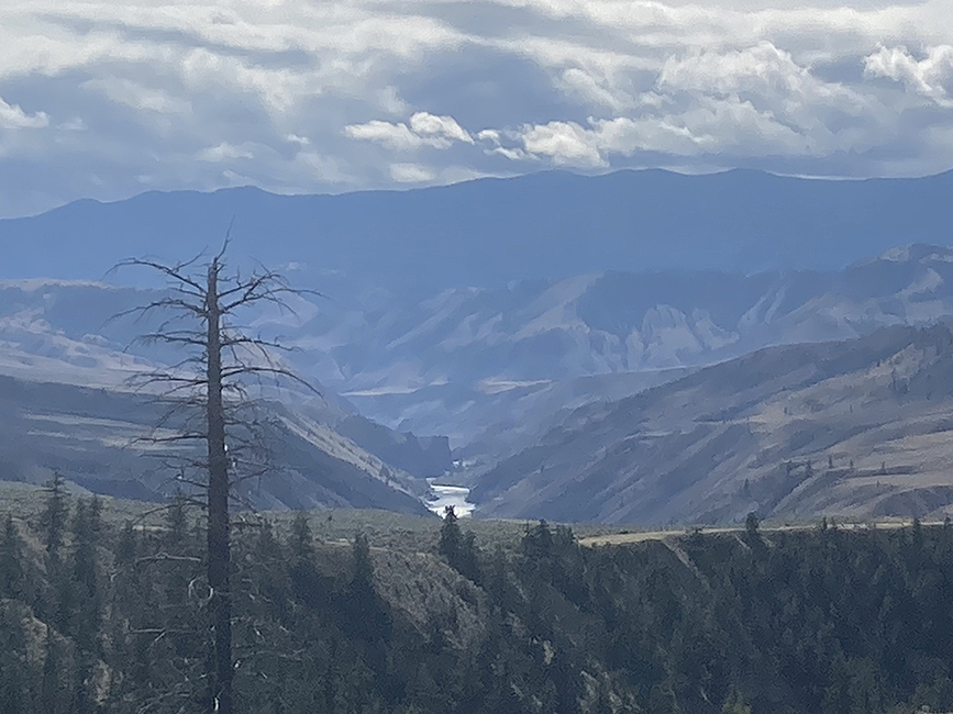
Mountainous country in the Cariboo-Chilcotin, with the Fraser River way below.
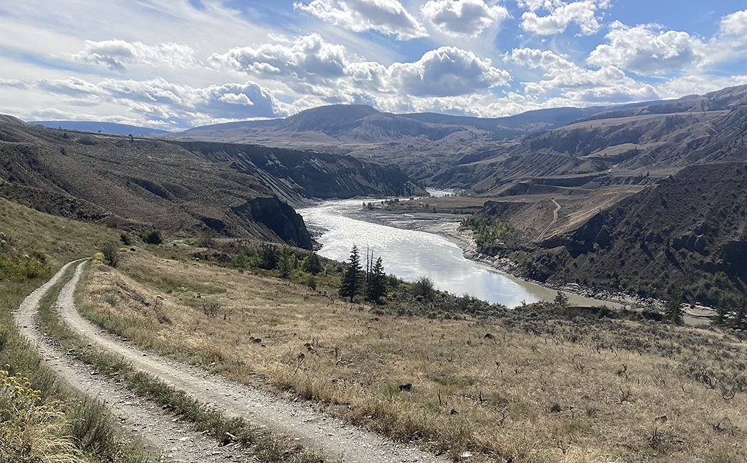
The Fraser River on the road to the Gang Ranch
The road north of the Gang Ranch, approaching the Chilcotin River
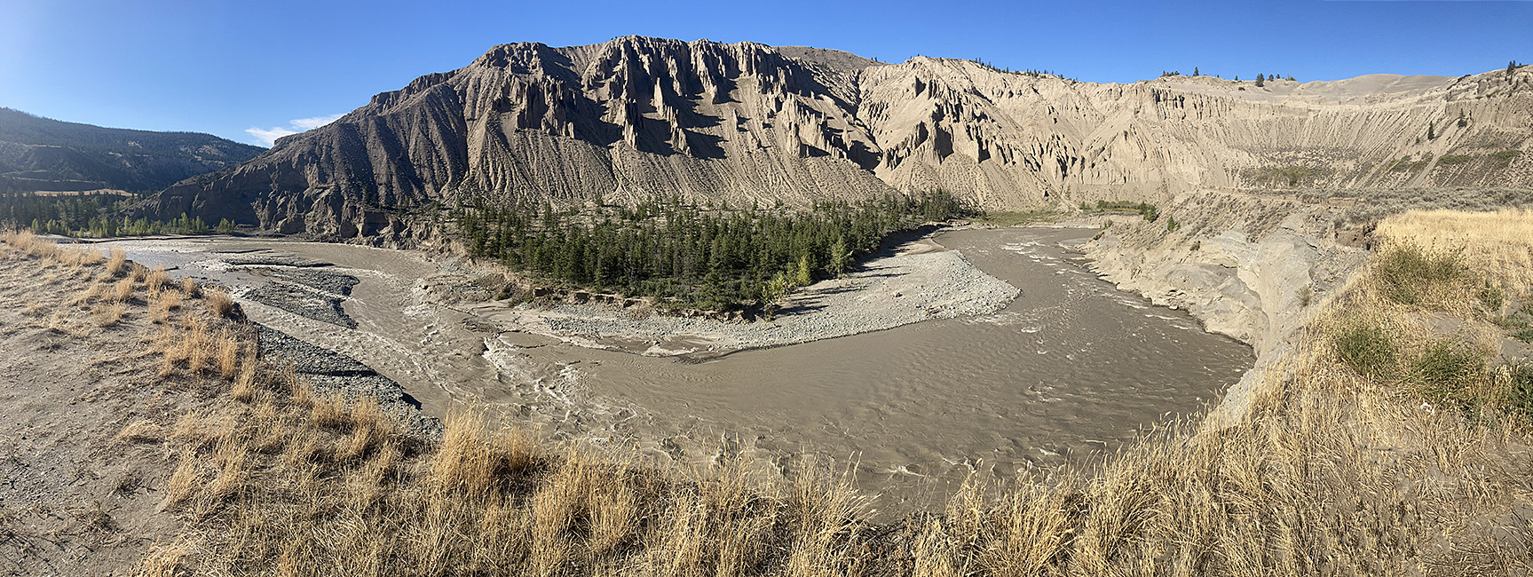
The Chilcotin River at Farwell Canyon. A major landslide upstream, a few weeks earlier, turned this river muddy.
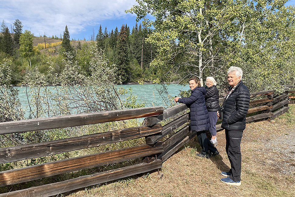
We stayed in rural lodges at Riske Creek and Anahim Lake.
A chilly morning at Bull Canyon park. The Chilcotin River above the recent landslide is a typical milky blue from glacial runoff.
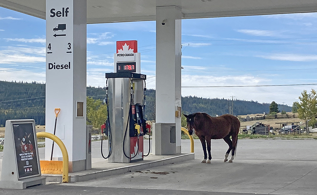
Waiting for a high horse-power fill-up? Redstone, on the Chilcotin-Bella Coola highway.
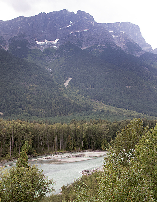
As we approached the coast, heading to Bella Coola we had lovely views of the coast mountains, with numerous glaciers and snow patches.
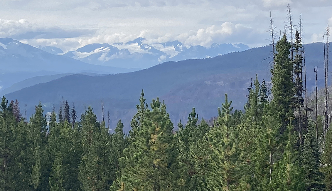
Coast mountains, seen from the Chilcotin-Bella Coola highway.
The road from Anahim Lake to Bella Coola includes a renowned and hair-raising section known as “The Hill”. This is a 43 km section of dirt road with no guardrails, numerous switchbacks and gradients as steep as 18%. The road descends 1,800 m from the Chilcotin plateau to the coastal valley. Fortunately we did this in good weather, with very little traffic, and I was thankful that our car has four-wheel-drive. This road was built in 1952-53, mostly by local people. The initial cost was only $1,800 per mile but in recent times millions have been spent on safety upgrades.
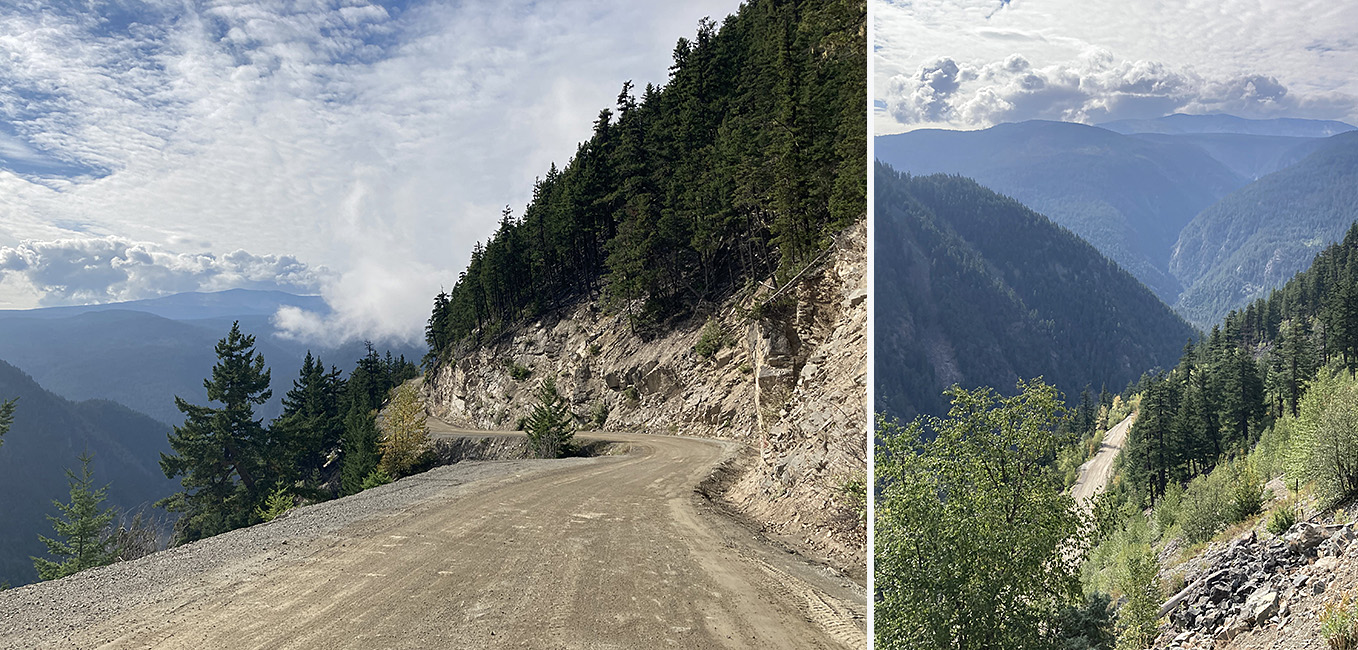
The notorious “Hill” road, going from the high Chilcotin plateau to the coastal lowlands at Bella Coola along the edge of a very steep canyon.
One of our goals in visiting Bella Coola in September was to witness the salmon run and, with luck, some Grizzly Bears that the spawning salmon attract. We stopped at a couple of spots along the river to watch dozens of Pink Salmon active at the shallow gravel beds where they spawn. At the official bear-watching site run by BC Parks at the Atnarko River we were soon rewarded with two bears.
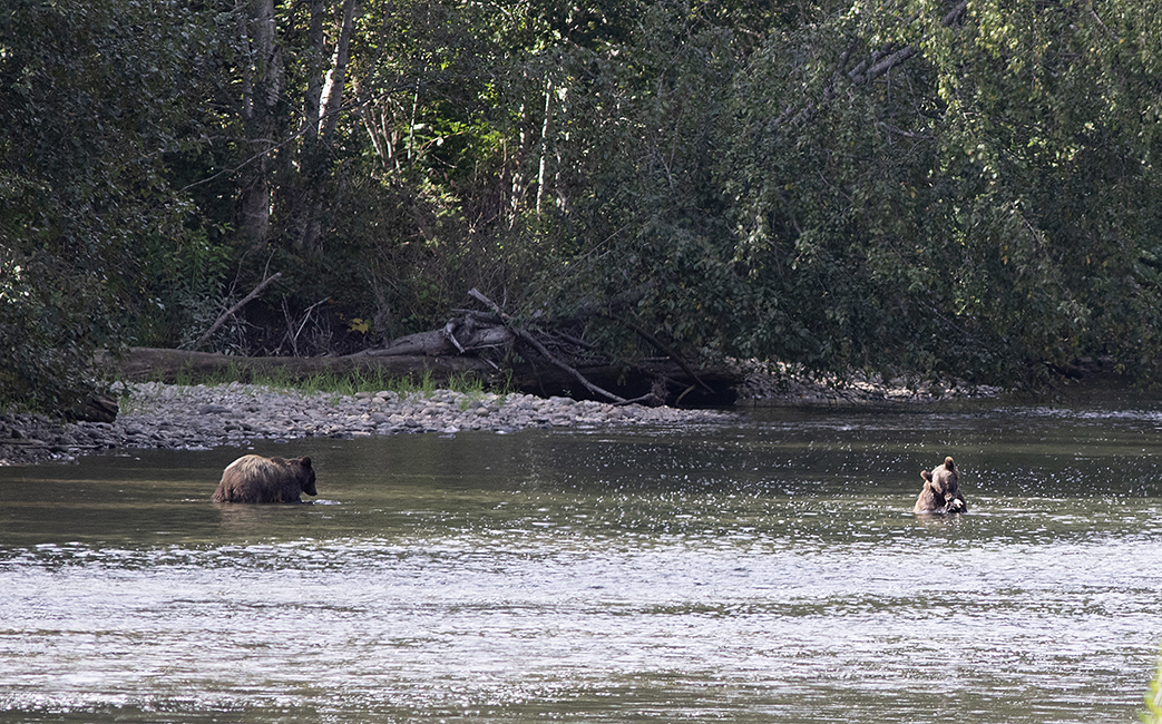
Two large grizzlies, evidently a mother and her two-year-old offspring catching salmon in the Atnarko River near Bella Coola.
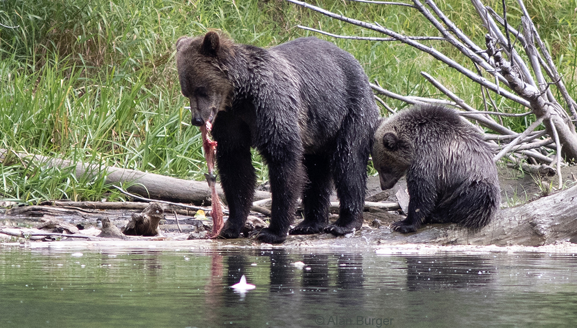
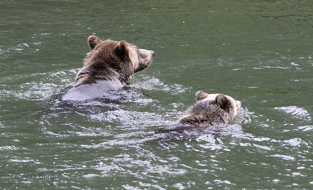
But these bears disappeared around a bend in the river and we decided to head for a lunch-spot at the park campsite a few km downstream. As we arrived, a man hurried past carrying a camera, so we followed. For the next hour or more, lunch forgotten, we were entranced watching a female grizzly with a small cub hunting salmon less than 100 m upstream. This was an unofficial bear-watching site, but the dozen or so people there were quiet and respectful and it was altogether a fabulous experience.
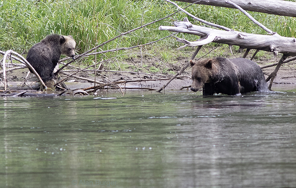
Mama grizzly and her cub at the Atnarko River near Bella Coola.
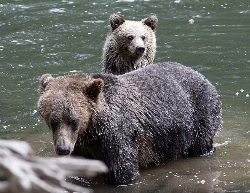
The cub was usually intently interested in what his mom was doing.
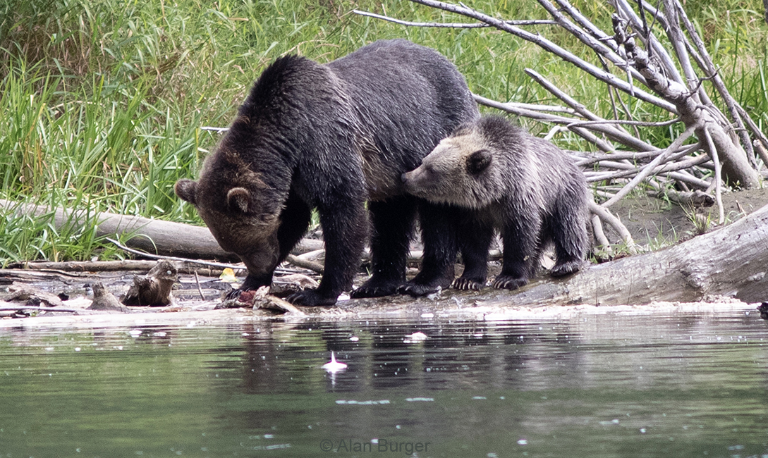
Mama grizzly eating a Pink Salmon, Atnarko River.
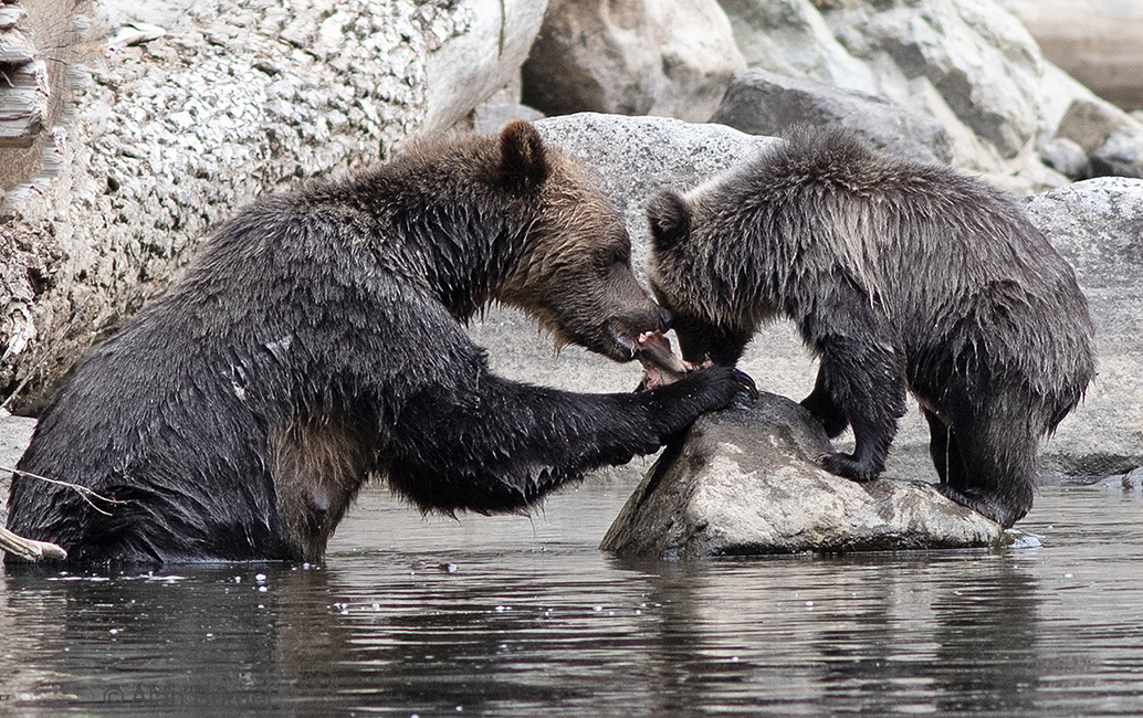
Mother and cub sharing a salmon.
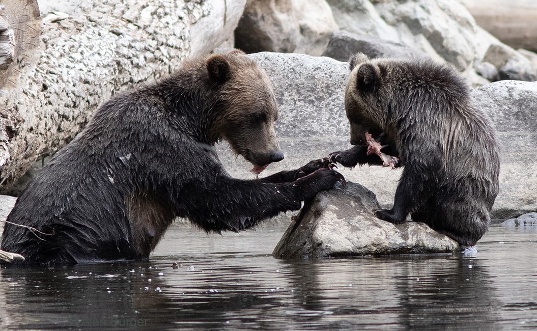
We were impressed at the amount of salmon they could eat, especially the adult female.
At one point the two bears headed downstream to where we were watching. Everyone moved well away from the river’s edge and the bears came down to within about 15 m of where our group had gathered.
The grizzlies just 15 m from where our group was gathered. The mother was deliberately ignoring us, but the cub, safe behind his mum, was extremely interested.
But mama bear decided this was not a good situation, so she took off across the river, with the cub close by.
Mother and cub swimming away across the river.
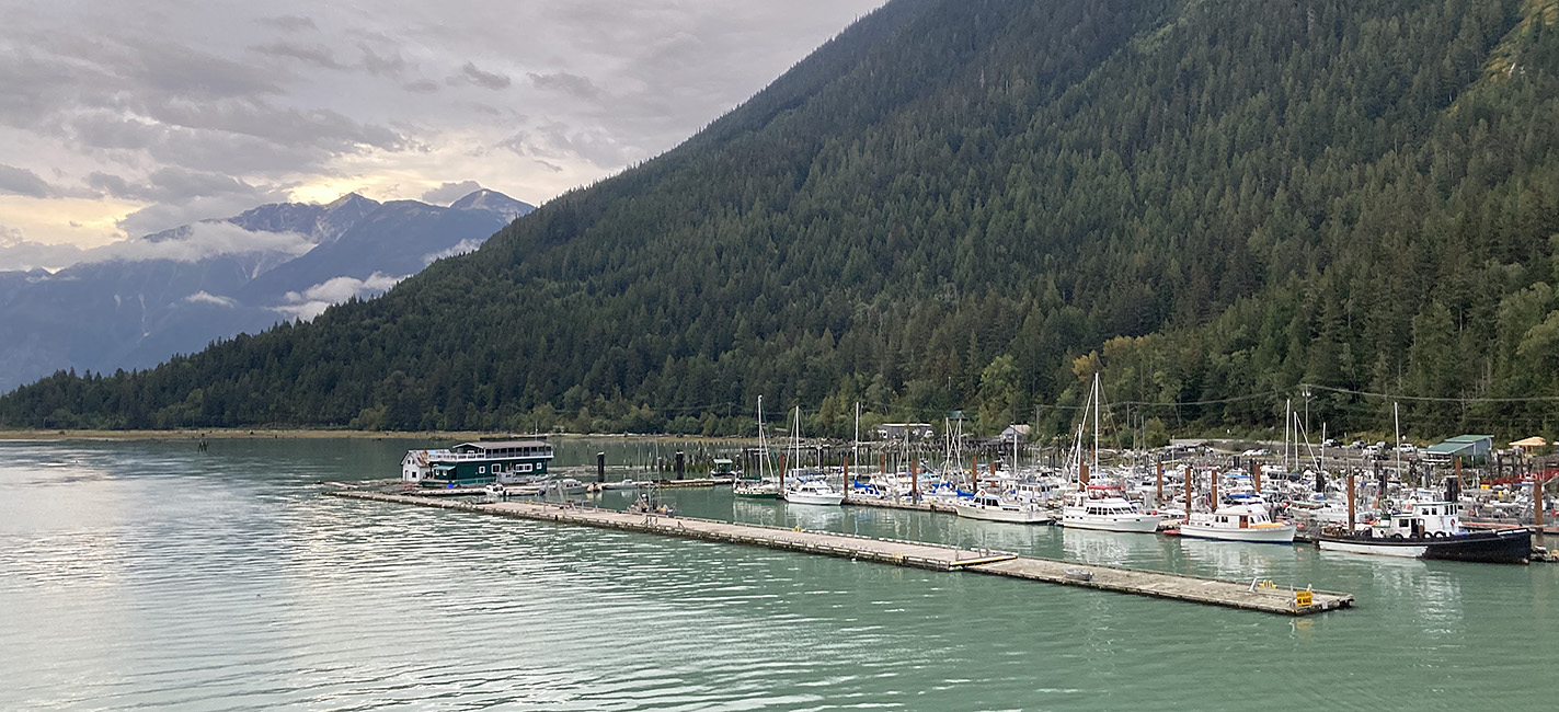
We stayed two nights in Bella Coola, exploring the town, the harbour, some impressive old forest patches and hiking part-way up the mountainside.
The Bella Coola River – milky from the glaciers up the mountains.
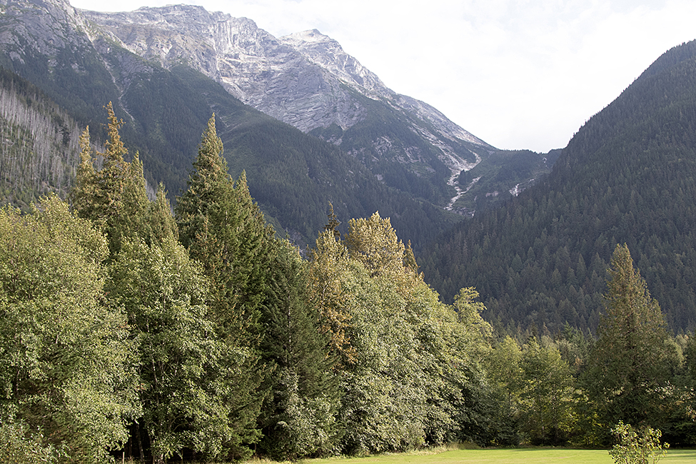
Mountains behind the lodge where we stayed outside Bella Coola. We scanned the slopes with binoculars for Mountain Goats but the ones we found turned out to be white boulders.

Hiking up the Snooka Creek trail to the lookout above Bella Coola.
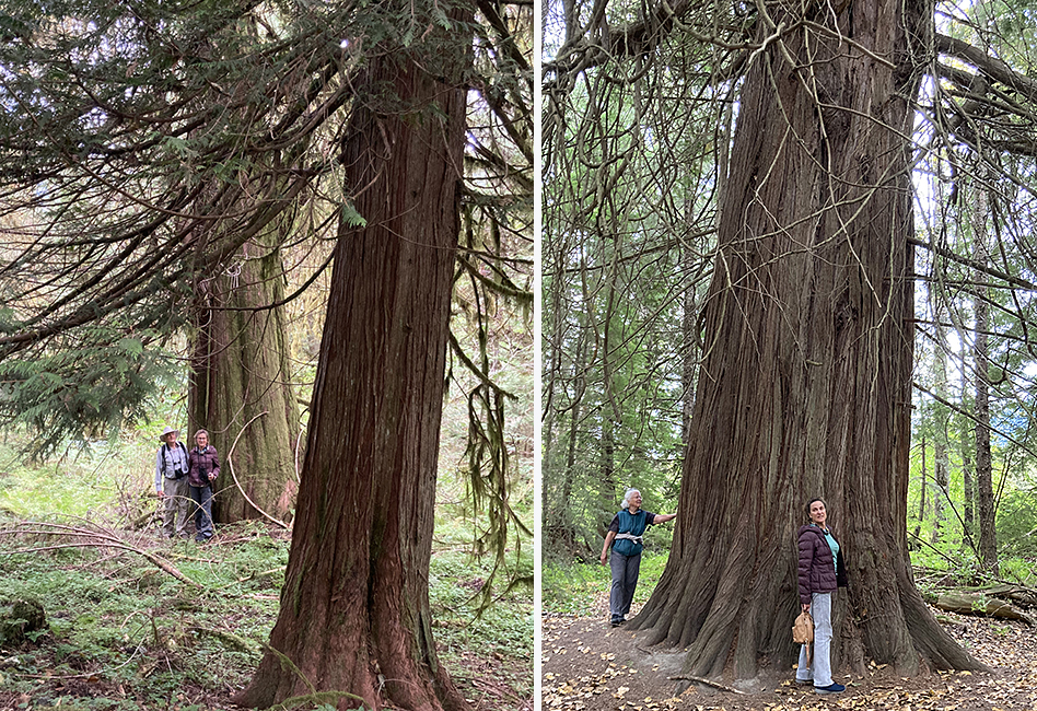
Some of the big Red Cedar trees in the Bella Coola valley.
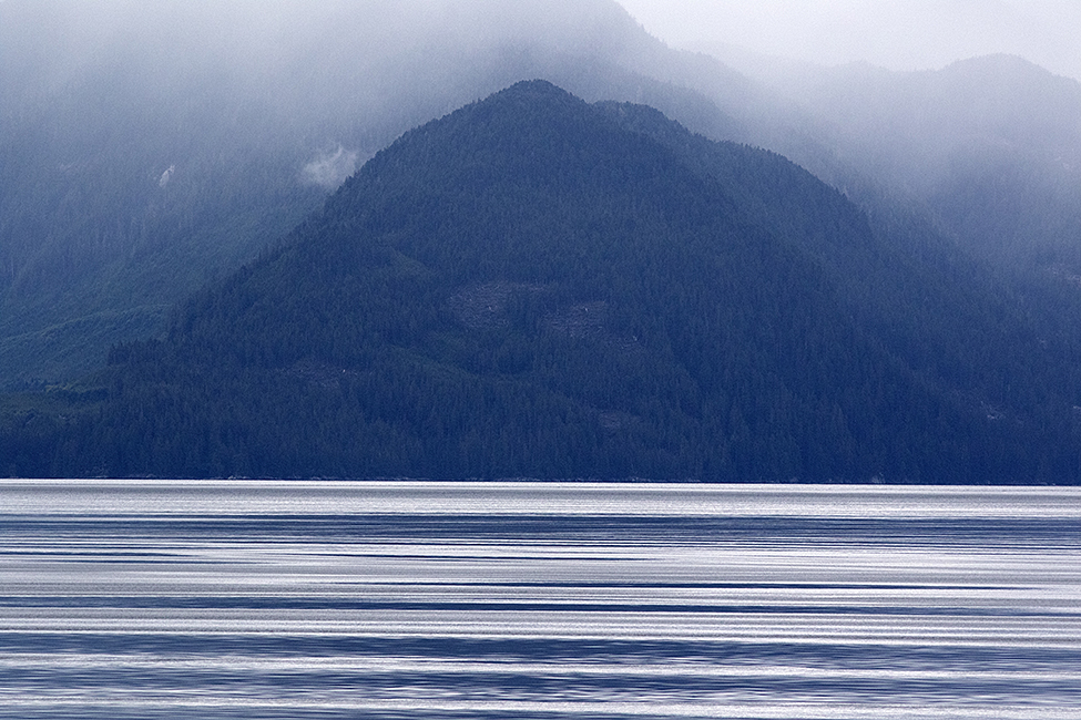
On September 13th we took the BC Ferry from Bella Coola to Port Hardy on Vancouver Island. This is a 10-hour ride through some spectacular coastal scenery: narrow fjords with high mountains, often topped by glaciers or snowfields. And regular sightings of interesting wildlife.
Leaving Bella Coola harbour on the Northern Sea Wolf ferry – 13 September 2024.

Fjord scenery from the ferry.
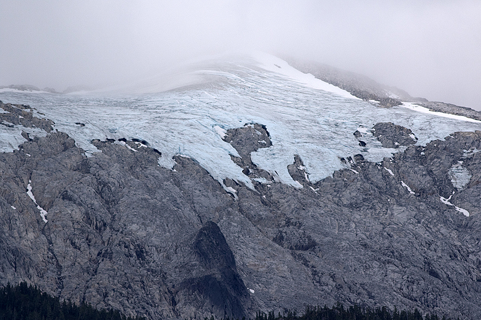
Old glacier ice on a peak – North Bentinck Arm near Bella Coola.
Interesting patterns in the calm sheltered ocean

Coastal mountain scenery from the ferry.
Marine wildlife became more frequent as we entered FitzHugh Sound and approached the open ocean at Queen Charlotte Sound. We passed 10 or more Humpback Whales – most of them too far to photograph.
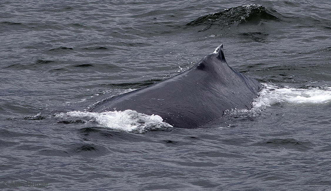
An adult Humpback Whale – Fitzhugh Sound
And a pod of six or more Orcas (Killer Whales)………
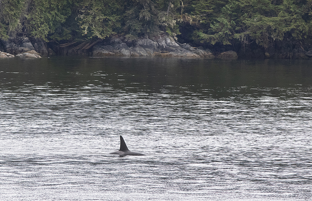
One of the Orcas in the pod we passed – Fitzhugh Sound.
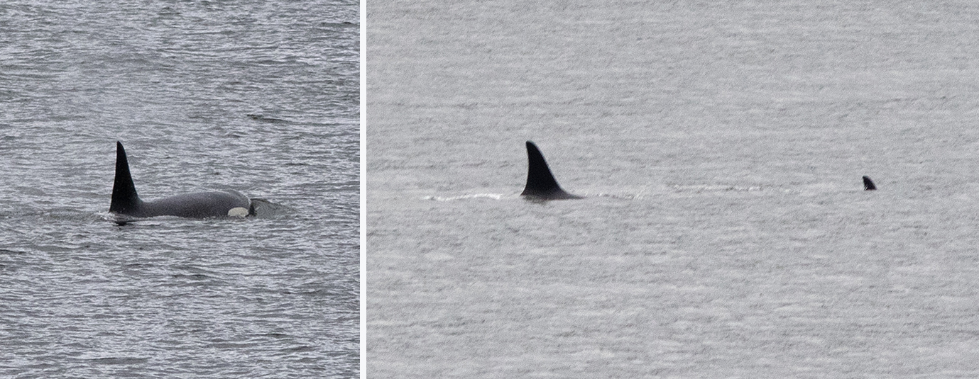
Three of the Orcas in the pod we passed.
At one point the ferry suddenly slowed down and we on the outer deck could see why – the ship almost hit a female Humpback Whale with a fairly small calf. The adult whale surfaced just a few metres from the ship and seconds later surged out of the water in a full-scale breach, ending in a huge splash. Too quick to catch with my camera.
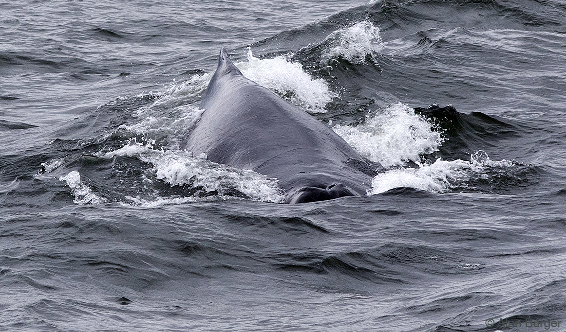
Female Humpback Whale close to the ferry – Fitzhugh Sound.

Baby Humpback imitating his mom, with an impressive breach – right out of the water.
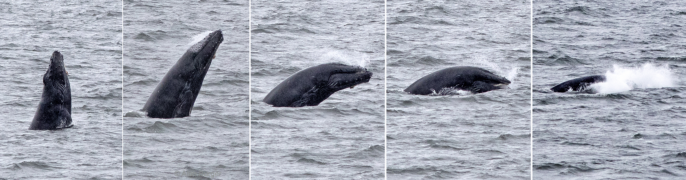
Baby then followed this with five more breaches – this sequence shows one of them.
The open sea as we crossed Queen Charlotte Sound produced some interesting oceanic seabirds – including both Sooty and Short-tailed Shearwaters, Black-legged Kittiwake and Parasitic Jaeger. Many seabirds and several Sea Otters were seen as we passed through Queen Charlotte Strait in the lee of Vancouver Island.
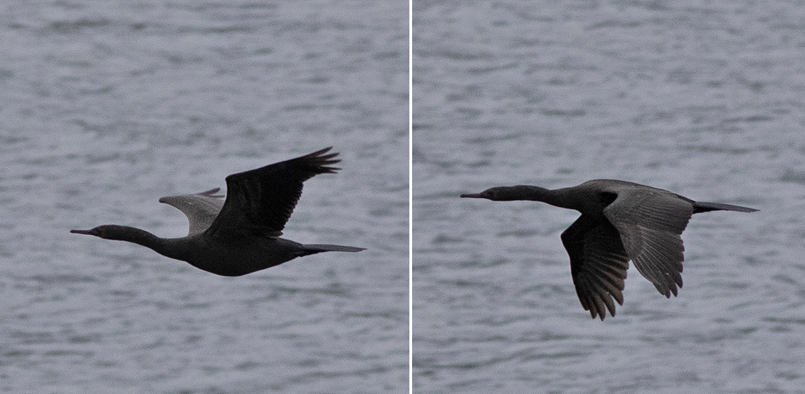
Pelagic Cormorant – Queen Charlotte Strait.
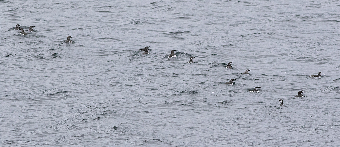
Common Murres – Queen Charlotte Strait
Misty scenery in Queen Charlotte Strait.
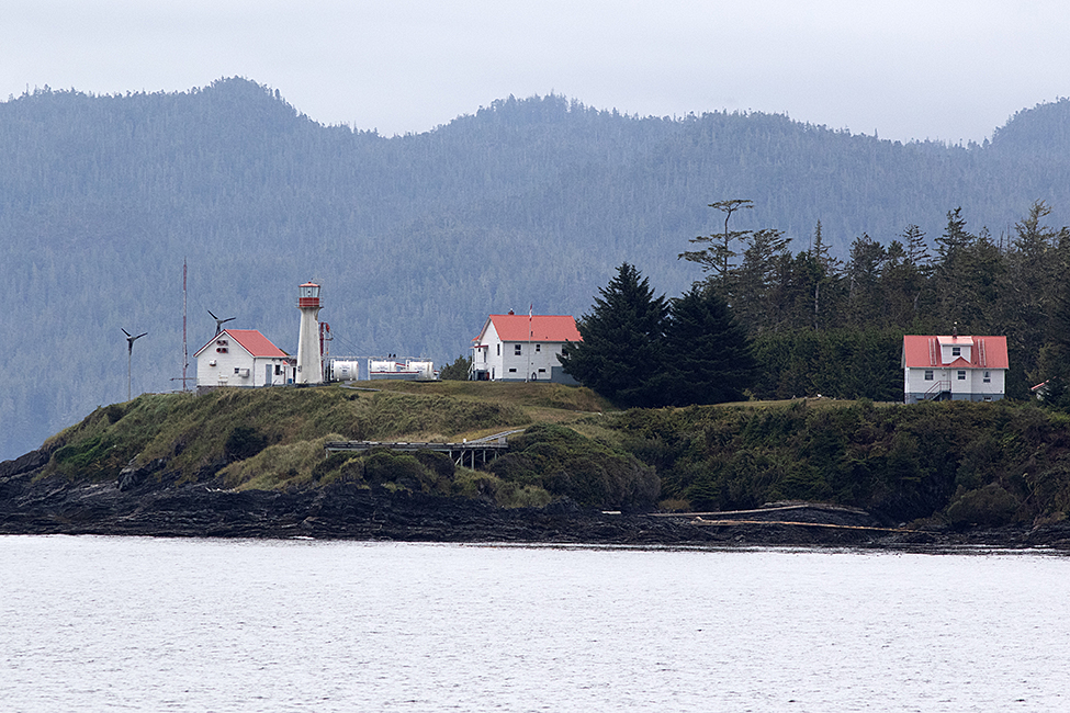
Scarlet Point Light-station, Queen Charlotte Strait
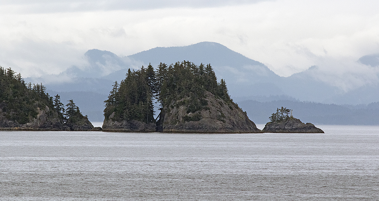
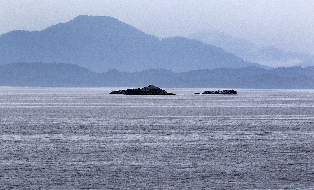
A curious split island – Queen Charlotte Strait.
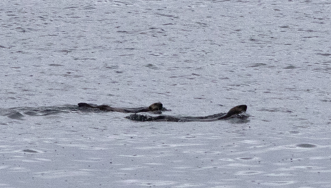
Sea Otters in the strait.
Arriving on Vancouver Island, we stayed a night in a cabin near Port McNeill. The next day we took the small ferry from McNeill to Alert Bay (‘Namgis) – a First Nations community on Cormorant Island. The community has built an impressive museum/cultural centre which has many repatriated artifacts and traditional art. Unfortunately, on a weekend in September, the centre was not open, but we enjoyed walking around the town and viewing the numerous totems and other traditional artworks.
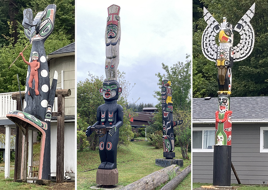
Some of the totems in Alert Bay, including two that are in front of private homes.
A wonderful eagle carving – Alert Bay
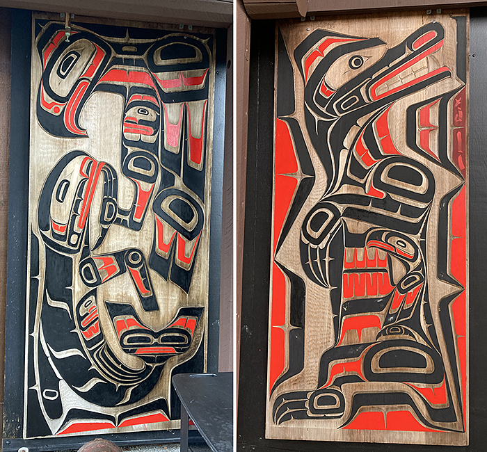
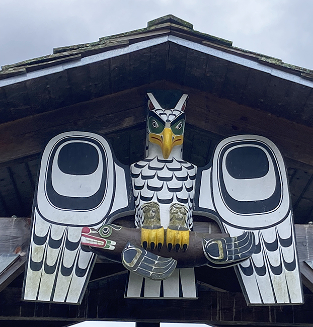
These are door panels at the cultural centre, Alert Bay.
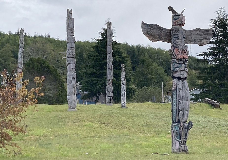
The ‘Namgis burial grounds have some of the older totems.
And then southward down Vancouver Island with a stop at Cathedral Grove to marvel at the few remaining big cedars and Douglas-fir trees.
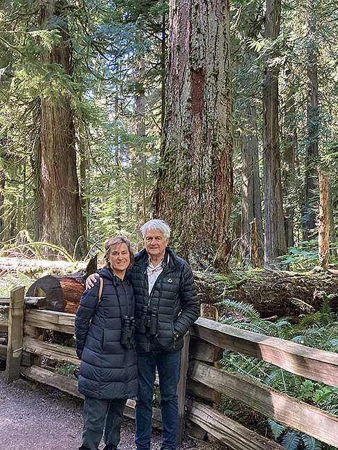
Marianne & Damien at Cathedral Grove, Vancouver Island
Finally, three nights in Victoria with very hospitable friends, visiting family and friends, and doing some of the touristy things in that lovely city ……
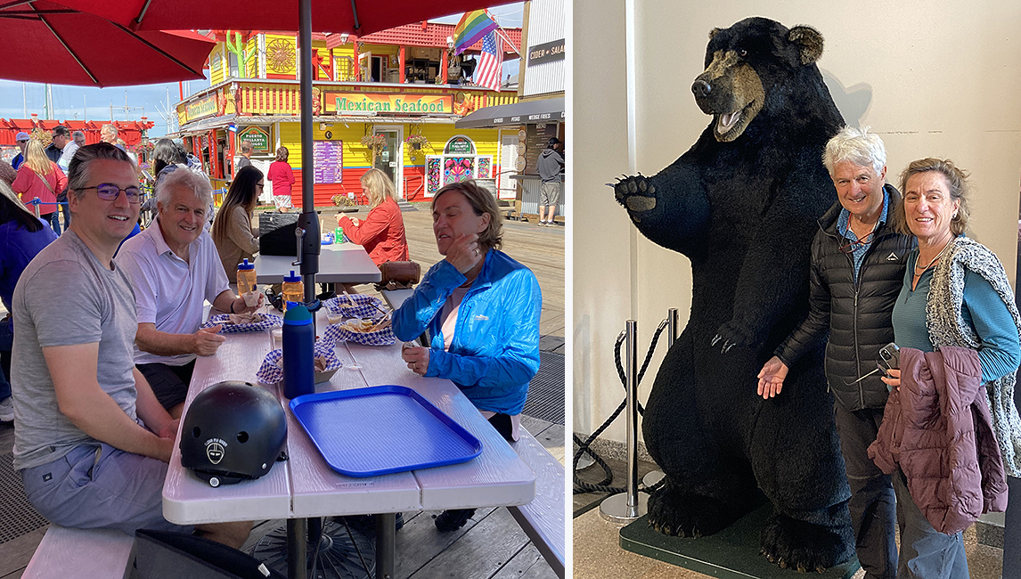
Corey, Damien & Marianne at Fisherman’s Wharf and doing the essential silly tourist thing at the Royal BC Museum.
~~~~~~~~~~~~~~~~~~~~~~~~~~~~~~~~~~~~~~~